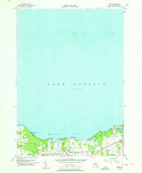
1955 Map of Texas
USGS Topo · Published 1957About this map
Lake Ontario defines the northern reaches of this coastal survey, where the waters of Mexico Bay meet a shoreline dotted with small summer communities and historic landmarks. The settlement of Texas sits inland near the Little Salmon River, while the lakefront is characterized by seasonal clusters like Demster Beach, Hickory Grove, and Shore Oaks. This mid-century landscape reflects a shift toward recreational use of the shore, anchored by the Spy Island Historical Site at Mexico Pt. Inland, the terrain is divided between the townships of Scriba, New Haven, and Mexico, with rural life organized along North Road and Catfish Road. Smaller watercourses like Catfish Creek and Butterfly Creek drain into the bay, cutting through the low-lying Butterfly Swamp before reaching the lake.
Find a feature on this map
22 named features on this map. Tap any name to fly to it.
Don’t see what you’re looking for? This feature index may not catch every label — zoom into the map to look around manually.
Map Details
Editions of this 1955 Texas Map
3 editions found
Other maps of this area

1895 · Pulaski
USGS Topo · 1:62,500

1900 · Fulton
USGS Topo · 1:62,500

1905 · Mexico
USGS Topo · 1:62,500

1943 · Pulaski
USGS Topo · 1:31,680

1943 · Oswego East
USGS Topo · 1:31,680

1943 · New Haven
USGS Topo · 1:31,680

1943 · Texas
USGS Topo · 1:31,680

1943 · Mexico
USGS Topo · 1:31,680
1943 · Ellisburg
USGS Topo · 1:31,680

1943 · West Of Texas
USGS Topo · 1:31,680