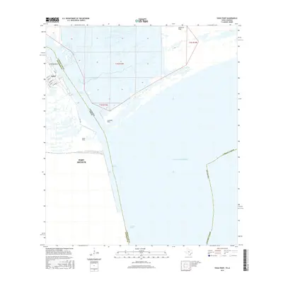
2016 Map of Texas Point
USGS Topo · Published 2016About this map
The coastal convergence of Jefferson County and Cameron Parish defines this maritime landscape where the Louisiana and Texas border meets the Gulf of Mexico. At the center of this industrial and natural crossroads is Sabine Pass, a vital waterway connecting inland commerce to the open sea. The settlement of Sabine sits just north of Mud Lake, with its local street grid including Welch St, Quinn St, and S 7th Ave terminating near the water's edge.
Find a feature on this map
28 named features on this map. Tap any name to fly to it.
Don’t see what you’re looking for? This feature index may not catch every label — zoom into the map to look around manually.
Map Details
Editions of this 2016 Texas Point Map
This is the sole edition of this map. No revisions or reprints were ever made.
Other maps of this area

1932 · Sabine Pass NE
USGS Topo · 1:31,680

1934 · Johnsons Bayou
USGS Topo · 1:24,000

1935 · Johnsons Bayou
USGS Topo · 1:31,680

1943 · West of Johnson Bayou
USGS Topo · 1:24,000

1943 · Port Arthur South
USGS Topo · 1:24,000

1944 · Sabine Pass
USGS Topo · 1:31,680

1944 · Texas Point
USGS Topo · 1:31,680
1946 · Sabine Pass NE
USGS Topo · 1:31,680
1946 · Port Arthur SE
USGS Topo · 1:31,680

1954 · Port Arthur
USGS Topo · 1:250,000