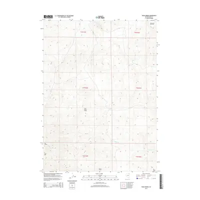
2014 Map of Texas Spring
USGS Topo · Published 2014About this map
Texas Spring and Opal Spring provide rare water sources in this high-elevation basin of northeastern Elko County. The landscape is defined by the sharp transition between the Toana John Mountains to the northeast and the H D Range to the southeast, with Knoll Mtn anchoring the western edge. This 2014 survey reveals a network of intermittent drainage systems, including Sulphur Cr and Trout Cr, which have carved deep features like Texas Spring Canyon and Bell Canyon into the terrain. The presence of CR-771 indicates the primary modern access route through this remote section of Nevada, while the numerous springs suggest the historical importance of these specific locations for livestock and early travel through the Great Basin.
Find a feature on this map
18 named features on this map. Tap any name to fly to it.
Don’t see what you’re looking for? This feature index may not catch every label — zoom into the map to look around manually.
Map Details
Editions of this 2014 Texas Spring Map
This is the sole edition of this map. No revisions or reprints were ever made.
Other maps of this area

1955 · Wells
USGS Topo · 1:250,000

1957 · Delaplain
USGS Topo · 1:62,500

1958 · Wells
USGS Topo · 1:250,000

1961 · Wells
USGS Topo · 1:250,000

1961 · Delano Mountains
USGS Topo · 1:62,500

1961 · Gollaher Mountain
USGS Topo · 1:62,500

1968 · Knoll Mountain
USGS Topo · 1:24,000

1968 · Knoll Mountain SE
USGS Topo · 1:24,000

1968 · Blanchard Mtn
USGS Topo · 1:24,000

1968 · Texas Spring
USGS Topo · 1:24,000