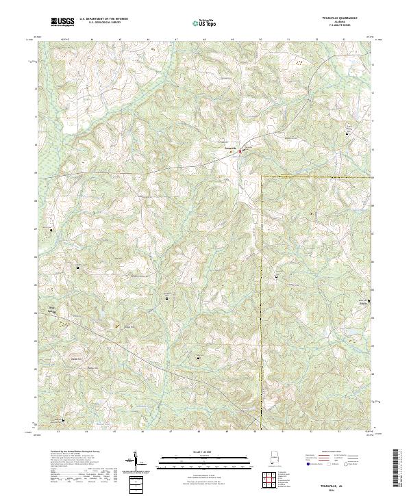
2024 Map of Texasville
USGS Topo · Published 2024About this map
Texasville serves as a central point in this rural landscape near the border of Barbour and Henry Counties. The terrain is defined by a series of distinct elevations, including Joe Hill, Shipes Hill, and Walker Hill, interspersed with numerous small water bodies like Spencers Pond and Wilkinson Pond. A high density of local cemeteries, such as Magnolia Memorial Cem, Adams Chapel Cem, and Springhill Cem, provides significant value for genealogists and local historians tracking family lineages in this portion of Alabama. The settlement pattern is largely dispersed along a network of county roads, with Blue Springs and Edwin marking the southern reaches of the map. Small drainage features like Indian Creek and Beaver Creek underscore the area's agricultural character, where the land is carved into a grid of townships and ranges reflecting the enduring legacy of the Public Land Survey System.
Find a feature on this map
58 named features on this map. Tap any name to fly to it.
Don’t see what you’re looking for? This feature index may not catch every label — zoom into the map to look around manually.
Map Details
Editions of this 2024 Texasville Map
This is the sole edition of this map. No revisions or reprints were ever made.
Other maps of this area

1953 · Dothan
USGS Topo · 1:250,000

1954 · Dothan
USGS Topo · 1:250,000

1955 · Dothan
USGS Topo · 1:250,000

1967 · Clayton South
USGS Topo · 1:24,000

1968 · Baker Hill
USGS Topo · 1:24,000

1968 · Louisville
USGS Topo · 1:24,000

1969 · Abbeville West
USGS Topo · 1:24,000
1969 · Clio
USGS Topo · 1:24,000
1969 · Texasville
USGS Topo · 1:24,000
1969 · Skipperville
USGS Topo · 1:24,000