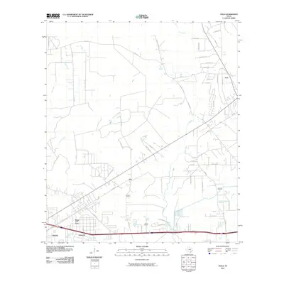
2010 Map of Texla
USGS Topo · Published 2010About this map
Cow Bayou and its numerous tributaries, including Tiger Creek and Caney Creek, dominate the drainage patterns of this corner of Orange County. The landscape is characterized by a network of winding local roads and modern residential developments such as Maple Crest Acres and Lakewood on the outskirts of Vidor. Farther north, the small community of Texla sits near the upper reaches of Cole Creek. Local history is preserved in small family and community burial grounds, specifically Singleton Cemetery and Linscomb Cemetery. The presence of Jenkins Airport and the grid of thoroughfares like Texla Rd and Bland Rd indicate a rural-suburban interface typical of Southeast Texas in the early 21st century. This survey documents the area's continued reliance on the bayou systems for drainage and the expansion of residential clusters into former timber or agricultural lands.
Find a feature on this map
59 named features on this map. Tap any name to fly to it.
Don’t see what you’re looking for? This feature index may not catch every label — zoom into the map to look around manually.
Map Details
Editions of this 2010 Texla Map
This is the sole edition of this map. No revisions or reprints were ever made.
Other maps of this area

1926 · Terry
USGS Topo · 1:24,000

1926 · Lakeview
USGS Topo · 1:24,000

1926 · Vidor
USGS Topo · 1:24,000

1926 · Texla
USGS Topo · 1:24,000

1926 · Mauriceville
USGS Topo · 1:24,000

1932 · Beaumont
USGS Topo · 1:62,500

1943 · Orangefield
USGS Topo · 1:24,000

1943 · Mauriceville
USGS Topo · 1:24,000

1943 · Terry
USGS Topo · 1:24,000

1943 · Texla
USGS Topo · 1:24,000