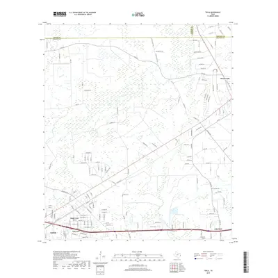
2019 Map of Texla
USGS Topo · Published 2019About this map
The intersection of Jasper, Newton, and Orange Counties defines this Southeast Texas landscape, where the low-lying wetlands of Sawgrass Marsh sit north of the developing outskirts of Vidor and Orange. Modern residential developments like Maple Crest Acres and Lakewood reflect the southward expansion of local communities, while the historic rural character remains evident in the numerous family-named roads and remote burial sites. Genealogists may find interest in the locations of Singleton Cem and Linscomb Cem, which are situated near the intricate drainages of Cow Bayou and Cole Cr. The community of Mauriceville anchors the northeastern portion of the sheet, serving as a transit point where Old State Hwy 62 and Old Buna Rd meet, illustrating the region's transition from marshy timberlands to organized settlements.
Find a feature on this map
152 named features on this map. Tap any name to fly to it.
Don’t see what you’re looking for? This feature index may not catch every label — zoom into the map to look around manually.
Map Details
Editions of this 2019 Texla Map
This is the sole edition of this map. No revisions or reprints were ever made.
Other maps of this area

1926 · Terry
USGS Topo · 1:24,000

1926 · Lakeview
USGS Topo · 1:24,000

1926 · Vidor
USGS Topo · 1:24,000

1926 · Texla
USGS Topo · 1:24,000

1926 · Mauriceville
USGS Topo · 1:24,000

1932 · Beaumont
USGS Topo · 1:62,500

1943 · Orangefield
USGS Topo · 1:24,000

1943 · Mauriceville
USGS Topo · 1:24,000

1943 · Terry
USGS Topo · 1:24,000

1943 · Texla
USGS Topo · 1:24,000