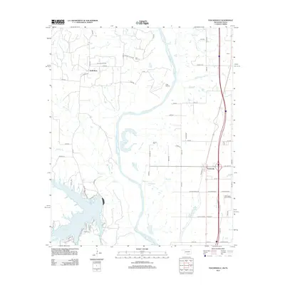
2012 Map of Thackerville
USGS Topo · Published 2012About this map
The Red River defines the border between Oklahoma and Texas on this 2012 survey, winding through a landscape of oxbow lakes and alluvial bottoms. On the Texas side, the Sivells Bend Oil Field and the settlement of Sivells Bend reflect the region's enduring energy economy, while the expansive Hubert M Moss Lake serves as a major hydrological feature to the southwest. Across the river in Oklahoma, Thackerville sits at a critical transit junction where Interstate 35 and the Railroad St corridor facilitate movement through Love County.
Find a feature on this map
80 named features on this map. Tap any name to fly to it.
Don’t see what you’re looking for? This feature index may not catch every label — zoom into the map to look around manually.
Map Details
Editions of this 2012 Thackerville Map
This is the sole edition of this map. No revisions or reprints were ever made.
Other maps of this area

1902 · Gainesville
USGS Topo · 1:125,000

1943 · Gainesville
USGS Topo · 1:125,000

1954 · Sherman
USGS Topo · 1:250,000

1958 · Sherman
USGS Topo · 1:250,000

1960 · Callisburg
USGS Topo · 1:24,000

1960 · Gainesville North
USGS Topo · 1:24,000

1961 · Muenster East
USGS Topo · 1:24,000
1967 · Marietta East
USGS Topo · 1:24,000
1968 · Thackerville
USGS Topo · 1:24,000
1968 · Burneyville
USGS Topo · 1:24,000