
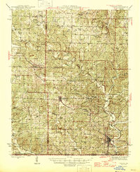
1946 Map of Thayer
USGS Topo · Published 1946About this map
Thayer stands as a significant rail hub along the southern edge of the Ozarks in the mid-1940s, anchored by the St Louis - San Francisco railroad. This survey captures a rural landscape defined by karst topography and small, interdependent communities like Koshkonong and Brandsville. The distribution of dozens of country schools, including Big Apple Sch, Red Ranch Sch, and Jolliff Sch, reflects a pre-consolidation era where education was deeply localized. The presence of natural features like Grand Gulf and numerous springs such as Batman Spr and Jolliff Spr highlights the region's complex hydrological character. Settlements like Rover and Old Town are mapped alongside local landmarks such as Victory Mission Ch and Woodside Cem, providing a detailed view of the human geography and family-named locations before the modern highway system fully transformed the Missouri-Arkansas border region.
Find a feature on this map
68 named features on this map. Tap any name to fly to it.
Don’t see what you’re looking for? This feature index may not catch every label — zoom into the map to look around manually.
Map Details
Editions of this 1946 Thayer Map
2 editions found
Other maps of this area

1931 · Bandyville
USGS Topo · 1:48,000

1938 · West Plains
USGS Topo · 1:24,000

1940 · West Plains
USGS Topo · 1:24,000

1943 · Thayer
USGS Topo · 1:62,500

1944 · West Plains
USGS Topo · 1:62,500

1944 · Couch
USGS Topo · 1:62,500

1944 · Birch Tree
USGS Topo · 1:62,500

1945 · Willow Springs
USGS Topo · 1:62,500

1945 · Montier
USGS Topo · 1:62,500

1946 · Couch
USGS Topo · 1:62,500