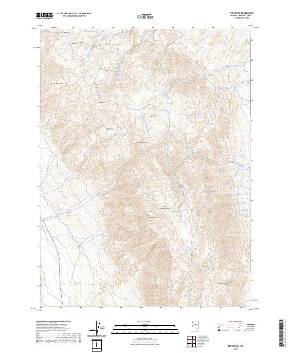
2023 Map of The Banjo
USGS Topo · Published 2023About this map
Granite Peak and the high ridges of the Granite Range dominate this corner of Washoe County, a landscape defined by seasonal water sources and upland meadows. The terrain is marked by high-elevation features like Skull Meadow, Granite Cr Meadow, and Clear Creek Meadow, which suggest a history of seasonal grazing or natural catchment in an otherwise arid environment. Along the northern edge, Wagon Tire Mountain and Wagon Tire Pass indicate traditional transit routes through the high country.
Find a feature on this map
29 named features on this map. Tap any name to fly to it.
Don’t see what you’re looking for? This feature index may not catch every label — zoom into the map to look around manually.
Map Details
Editions of this 2023 The Banjo Map
This is the sole edition of this map. No revisions or reprints were ever made.
Other maps of this area

1886 · Granite Range
USGS Topo · 1:250,000

1894 · Granite Range
USGS Topo · 1:250,000

1955 · Lovelock
USGS Topo · 1:250,000

1959 · Lovelock
USGS Topo · 1:250,000

1964 · Gerlach
USGS Topo · 1:62,500

1980 · Melody Mountain
USGS Topo · 1:24,000
1980 · The Banjo
USGS Topo · 1:24,000
1980 · Hualapai Flat North
USGS Topo · 1:24,000

1980 · Wall Spring
USGS Topo · 1:24,000
1980 · Hualapai Flat South
USGS Topo · 1:24,000