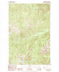
1985 Map of The Brothers
USGS Topo · Published 1985About this map
The Brothers, a prominent peak in the Olympic Range, anchors this mid-1980s topographical study of the high country where Olympic National Park meets Olympic National Forest. The landscape is defined by the deep drainages of the Dosewallips River and the Duckabush River, which provide the primary corridors for wilderness access. This era of forest management is evidenced by specific recreational infrastructure, including the Dosewallips Ranger Sta, the Dosewallips Campground, and backcountry sites like Dose Forks Camp and Tenmile Camp. High-elevation water bodies such as Lake Constance, Wildcat Lake, and Upper Lena Lake are mapped alongside smaller features like Milk Lake and Soda Spring, illustrating a complex network of alpine hydrology feeding into the larger river systems.
Find a feature on this map
32 named features on this map. Tap any name to fly to it.
Don’t see what you’re looking for? This feature index may not catch every label — zoom into the map to look around manually.
Map Details
Editions of this 1985 The Brothers Map
2 editions found
Other maps of this area

1938 · Mt Constance
USGS Topo · 1:125,000

1944 · Mt. Angeles
USGS Topo · 1:62,500

1946 · Mt. Angeles
USGS Topo · 1:62,500

1946 · Tyler Peak
USGS Topo · 1:62,500

1947 · The Brothers
USGS Topo · 1:62,500

1947 · Mt. Steel
USGS Topo · 1:62,500

1948 · Tyler Peak
USGS Topo · 1:62,500

1950 · The Brothers
USGS Topo · 1:62,500

1950 · Mt. Steel
USGS Topo · 1:62,500

1958 · Seattle
USGS Topo · 1:250,000