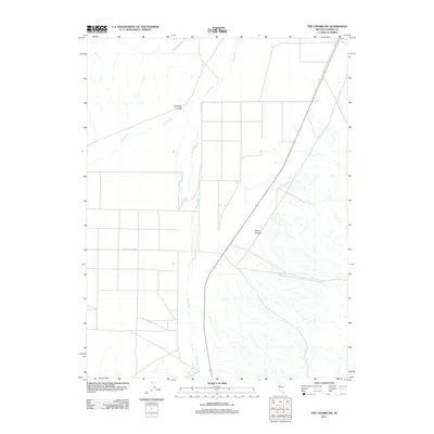
2011 Map of The Cedars SW
USGS Topo · Published 2011About this map
Antelope Valley defines the wide, arid corridor of this region in central Nevada, where the northward-flowing Reese River and its seasonal tributary, Cain Creek, dictate the geography of the basin. The landscape is marked by the stark geometry of desert roads and sections, with Antelope Valley Rd providing one of the few primary access points across the valley floor. To the east, the terrain rises toward Wood Canyon, showing the transition from the flat river valley to the more varied topography of the surrounding ranges. This 2011 survey records a remote segment of the Great Basin, capturing a moment when traditional land divisions and fundamental natural watercourses remained the primary features of an open, largely undeveloped high-desert environment.
Find a feature on this map
5 named features on this map. Tap any name to fly to it.
Don’t see what you’re looking for? This feature index may not catch every label — zoom into the map to look around manually.
Map Details
Editions of this 2011 The Cedars SW Map
This is the sole edition of this map. No revisions or reprints were ever made.
Other maps of this area

1932 · Sonoma Range
USGS Topo · 1:250,000

1939 · Sonoma Range
USGS Topo · 1:250,000

1955 · Millett
USGS Topo · 1:250,000

1955 · Winnemucca
USGS Topo · 1:250,000

1958 · Winnemucca
USGS Topo · 1:250,000

1959 · Millett
USGS Topo · 1:250,000

1961 · The Cedars
USGS Topo · 1:62,500

1961 · Mt. Moses
USGS Topo · 1:62,500

1962 · Winnemucca
USGS Topo · 1:250,000
1969 · Manhattan Mtn NW
USGS Topo · 1:24,000