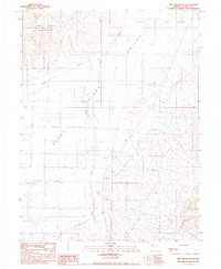
1990 Map of The Cedars SW
USGS Topo · Published 1990About this map
The Reese River carves a central path through this Nevada landscape, separating the high elevations of the Fish Creek Mountains to the northwest from the Shoshone Range in the southeast. This 1990 provisional survey documents a transition between the broad, flat Valley of the Moon and the complex mountain terrain. Evidence of infrastructure is concentrated along the river valley, where a Landing Strip and multiple Gravel Pit operations are noted. Water management is a primary theme of the area, as seen in the seasonal drainage of Cain Creek and the numerous wells marked throughout the valley floor, reflecting the region's reliance on groundwater for ranching and local industry during the late 20th century.
Find a feature on this map
8 named features on this map. Tap any name to fly to it.
Don’t see what you’re looking for? This feature index may not catch every label — zoom into the map to look around manually.
Map Details
Editions of this 1990 The Cedars SW Map
This is the sole edition of this map. No revisions or reprints were ever made.
Other maps of this area

1932 · Sonoma Range
USGS Topo · 1:250,000

1939 · Sonoma Range
USGS Topo · 1:250,000

1955 · Millett
USGS Topo · 1:250,000

1955 · Winnemucca
USGS Topo · 1:250,000

1958 · Winnemucca
USGS Topo · 1:250,000

1959 · Millett
USGS Topo · 1:250,000

1961 · The Cedars
USGS Topo · 1:62,500

1961 · Mt. Moses
USGS Topo · 1:62,500

1962 · Winnemucca
USGS Topo · 1:250,000
1969 · Manhattan Mtn NW
USGS Topo · 1:24,000