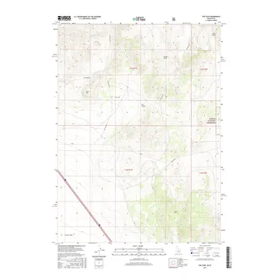
2017 Map of The Cove
USGS Topo · Published 2017About this map
The Cove marks a distinct geographic feature where the high country of the Sublett Range meets the northern expanse of the Curlew Valley along the Idaho-Utah border. This landscape is defined by its deep drainages and volcanic or tectonic uplifts, including the Stone Hills and the prominent Table Mtn. Human presence in this high-desert environment is traced through a network of secondary routes such as Cow Canyon Rd and Black Pine Rd, which connect the scattered canyons and grazing lands. A significant portion of the eastern terrain is protected within the Curlew National Grassland, reflecting a land-use history focused on conservation and open-range management. The map details the transition from steep-walled topography like North Canyon and Dry Canyon to the broad alluvial plains that stretch toward the Great Salt Lake basin to the south.
Find a feature on this map
16 named features on this map. Tap any name to fly to it.
Don’t see what you’re looking for? This feature index may not catch every label — zoom into the map to look around manually.
Map Details
Editions of this 2017 The Cove Map
This is the sole edition of this map. No revisions or reprints were ever made.
Other maps of this area

1954 · Pocatello
USGS Topo · 1:250,000

1954 · Brigham City
USGS Topo · 1:250,000

1958 · Pocatello
USGS Topo · 1:250,000

1958 · Brigham City
USGS Topo · 1:250,000

1962 · Brigham City
USGS Topo · 1:250,000

1968 · Monument Peak NW
USGS Topo · 1:24,000

1968 · Snowville
USGS Topo · 1:24,000

1968 · Monument Peak NE
USGS Topo · 1:24,000

1973 · Juniper
USGS Topo · 1:24,000

1973 · The Cove
USGS Topo · 1:24,000