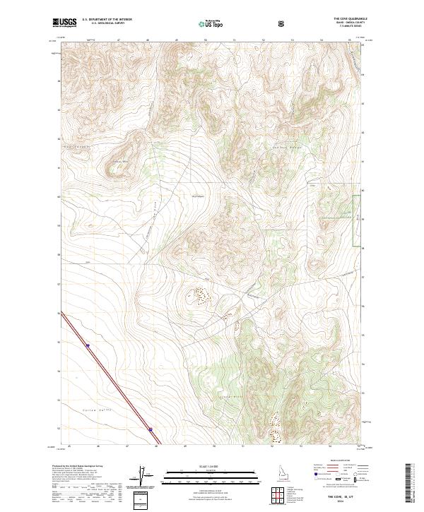
2024 Map of The Cove
USGS Topo · Published 2024About this map
The Stone Hills rise above the southern expanse of this Idaho landscape, which transitions from the open floor of Curlew Valley into the high elevations of the Sublett Range. Recent surveying records a network of backcountry routes such as Cow Hollow Rd and Black Pine Rd, which navigate the complex topography of The Cove and Dry Canyon. A significant portion of the eastern territory is designated as the Curlew National Grassland, reflecting a modern conservation and land-use pattern within the high desert environment. The map captures the distinct geographic markers of the region, from the prominence of Table Mtn to the drainage of North Canyon, providing a clear view of the area's physical geography in the current decade.
Find a feature on this map
17 named features on this map. Tap any name to fly to it.
Don’t see what you’re looking for? This feature index may not catch every label — zoom into the map to look around manually.
Map Details
Editions of this 2024 The Cove Map
This is the sole edition of this map. No revisions or reprints were ever made.
Other maps of this area

1954 · Pocatello
USGS Topo · 1:250,000

1954 · Brigham City
USGS Topo · 1:250,000

1958 · Pocatello
USGS Topo · 1:250,000

1958 · Brigham City
USGS Topo · 1:250,000

1962 · Brigham City
USGS Topo · 1:250,000

1968 · Monument Peak NW
USGS Topo · 1:24,000

1968 · Snowville
USGS Topo · 1:24,000

1968 · Monument Peak NE
USGS Topo · 1:24,000

1973 · Juniper
USGS Topo · 1:24,000

1973 · The Cove
USGS Topo · 1:24,000