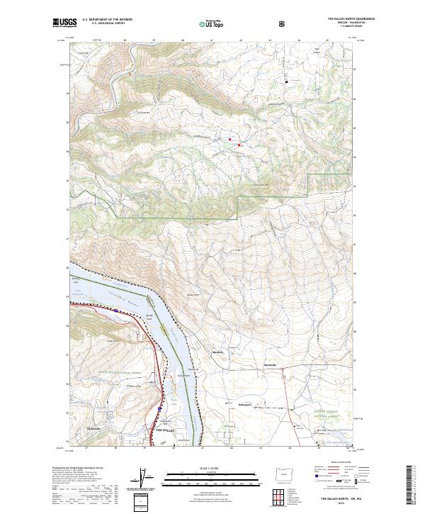
2023 Map of The Dalles North
USGS Topo · Published 2023About this map
The Dalles and Chenoweth anchor the southern shore of the Columbia River in this modern topographic study of the Columbia Gorge. The landscape is defined by the sharp transition from the riverbanks to the towering Columbia Hills and the deep incisions of Green Canyon and Stanley Canyon on the Washington side. The map documents the enduring importance of the river corridor as a transit hub, featuring the BNSF Railway and several designated points such as Squally Point and Windy Point. Smaller agricultural and residential communities like Dallesport, Smithville, and Murdock dot the northern banks, while public lands of the Mount Hood National Forest and Gifford Pinchot National Forest reach into the quadrangle. Genealogists may find interest in the documented locations of the Lone Pine Cem and Wish-Ulm Cem.
Find a feature on this map
68 named features on this map. Tap any name to fly to it.
Don’t see what you’re looking for? This feature index may not catch every label — zoom into the map to look around manually.
Map Details
Editions of this 2023 The Dalles North Map
This is the sole edition of this map. No revisions or reprints were ever made.
Other maps of this area

1934 · The Dalles
USGS Topo · 1:125,000

1953 · The Dalles
USGS Topo · 1:250,000

1956 · The Dalles
USGS Topo · 1:250,000

1957 · The Dalles
USGS Topo · 1:250,000

1957 · Klickitat
USGS Topo · 1:62,500

1957 · The Dalles
USGS Topo · 1:62,500

1957 · White Salmon
USGS Topo · 1:62,500

1957 · Husum
USGS Topo · 1:62,500

1974 · Stacker Butte
USGS Topo · 1:24,000

1974 · The Dalles North
USGS Topo · 1:24,000