1975 Map of The Dalles South
USGS Topo · Published 1980About this map
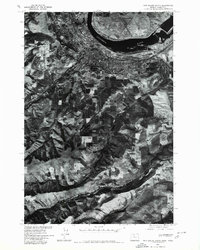
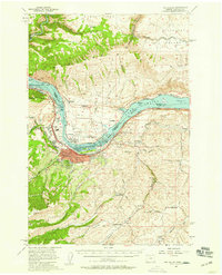
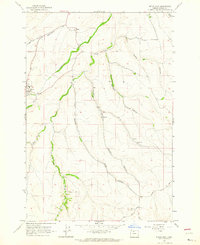
The Dalles serves as the focal point of this 1975 orthophotoquad, situated along the southern bank of the Columbia River. This aerial perspective, captured in cooperation with the Soil Conservation Service, provides a clear visual record of the city's mid-1970s development and its relationship with the surrounding agricultural and volcanic landscape. To the south, the deep drainage of Fivemile Creek cuts through the plateaus, revealing the intricate patterns of land use and orchard cultivation that define the region's economy. The orthophotographic format offers a unique view of the river's edge and the industrial and transportation infrastructure concentrated at this historic Columbia River Gorge crossing point, documenting the area's transition from the water's edge into the rising topography of north-central Oregon.
Find a feature on this map
3 named features on this map. Tap any name to fly to it.
Don’t see what you’re looking for? This feature index may not catch every label — zoom into the map to look around manually.
Map Details
Editions of this 1975 The Dalles South Map
This is the sole edition of this map. No revisions or reprints were ever made.
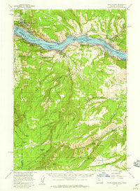
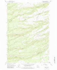
Other maps of this area

1930 · Dufur
USGS Topo · 1:125,000

1934 · Dufur
USGS Topo · 1:125,000

1934 · The Dalles
USGS Topo · 1:125,000

1953 · The Dalles
USGS Topo · 1:250,000

1956 · The Dalles
USGS Topo · 1:250,000

1957 · The Dalles
USGS Topo · 1:250,000
1957 · The Dalles
USGS Topo · 1:62,500
1957 · White Salmon
USGS Topo · 1:62,500
1962 · Wolf Run
USGS Topo · 1:24,000
1962 · Dufur East
USGS Topo · 1:24,000