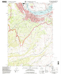
1994 Map of The Dalles South
USGS Topo · Published 1995About this map
The Dalles serves as a critical Columbia River hub, where the The Dalles Bridge and The Dalles Dam anchor the regional economy. This 1990s survey illustrates a landscape of established civic life and agricultural transition, from the industrial grain elevators and Union Pacific rail lines near Lake Celilo to the surrounding orchards and heights. The map preserves the locations of several historic burial grounds, including the IOOF Cem and Pioneer Cem, alongside institutions like St Marys Academy.
Find a feature on this map
48 named features on this map. Tap any name to fly to it.
Don’t see what you’re looking for? This feature index may not catch every label — zoom into the map to look around manually.
Map Details
Editions of this 1994 The Dalles South Map
This is the sole edition of this map. No revisions or reprints were ever made.
Other maps of this area

1930 · Dufur
USGS Topo · 1:125,000

1934 · Dufur
USGS Topo · 1:125,000

1934 · The Dalles
USGS Topo · 1:125,000

1953 · The Dalles
USGS Topo · 1:250,000

1956 · The Dalles
USGS Topo · 1:250,000

1957 · The Dalles
USGS Topo · 1:250,000

1957 · The Dalles
USGS Topo · 1:62,500

1957 · White Salmon
USGS Topo · 1:62,500

1962 · Wolf Run
USGS Topo · 1:24,000

1962 · Dufur East
USGS Topo · 1:24,000