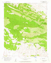
1961 Map of The Dark Hole
USGS Topo · Published 1962About this map
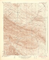
Black Mountain and Castle Mountain dominate this corner of the California Coast Ranges, where the boundaries of Fresno, Monterey, and Kings Counties converge. The landscape is defined by isolated outposts like the Riley Cabin and Taylor Ranch, connected by a network of trails and jeep tracks through The Dark Hole Canyon and across Turkey Flat. Evidence of early 20th-century resource extraction is visible in the presence of Kings Mine, White Mine, and several oil wells situated near Kreyenhagen Hills. The terrain is marked by numerous seasonal water sources such as Vaquero Spring and Sugar Tail Spring, which were vital for the scattered homesteads and livestock operations of the era. A remote Airstrip located near the Carollo Cabin suggests the increasing role of aviation in managing these high-elevation rangelands during the early 1960s.
Find a feature on this map
41 named features on this map. Tap any name to fly to it.
Don’t see what you’re looking for? This feature index may not catch every label — zoom into the map to look around manually.
Map Details
Editions of this 1961 The Dark Hole Map
4 editions found
Other maps of this area

1912 · Coalinga
USGS Topo · 1:125,000

1914 · Cholame
USGS Topo · 1:125,000

1915 · Cholame
USGS Topo · 1:125,000

1917 · Cholame
USGS Topo · 1:125,000

1930 · Canoas Creek
USGS Topo · 1:31,680

1934 · The Dark Hole
USGS Topo · 1:31,680

1934 · Reef Ridge
USGS Topo · 1:31,680

1934 · Canoas Creek
USGS Topo · 1:31,680

1936 · Kreyenhagen Hills
USGS Topo · 1:31,680
1937 · Reef Ridge
USGS Topo · 1:31,680