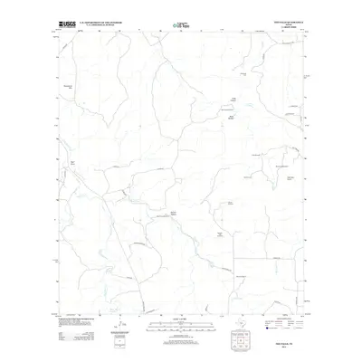
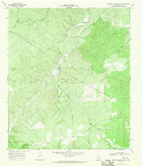
2012 Map of The Falls
USGS Topo · Published 2012About this map
Anderegg Cem sits in the northern reaches of this Gillespie County landscape, a marker of family heritage in a region defined by its water sources and livestock infrastructure. The drainage of Salt Cr and the Falls Prong of the Llano River system dictate the placement of Numerous ranching features, including the Rock House Windmill and Bierschwale Windmill. Significant topographic landmarks like Steamboat Mtn and Hermans Point rise above a network of hollows and draws, such as Bone Hollow and Wolf Draw. This 2012 survey illustrates the modern configuration of rural Texas ranch lands, where traditional water features like Garden Spring and Falls Prong Spring coexist with the White Oak Cr Reservoir and a grid of county roads servicing remote holdings.
Find a feature on this map
46 named features on this map. Tap any name to fly to it.
Don’t see what you’re looking for? This feature index may not catch every label — zoom into the map to look around manually.
Map Details
Editions of this 2012 The Falls Map
This is the sole edition of this map. No revisions or reprints were ever made.
Other maps of this area

1887 · Mason
USGS Topo · 1:125,000

1894 · Mason
USGS Topo · 1:125,000

1894 · Kerrville
USGS Topo · 1:125,000

1954 · Llano
USGS Topo · 1:250,000

1955 · Llano
USGS Topo · 1:250,000

1956 · Llano
USGS Topo · 1:250,000
1967 · Harper East
USGS Topo · 1:24,000
1967 · Panther Creek
USGS Topo · 1:24,000
1967 · Doss
USGS Topo · 1:24,000
1967 · Monument Mountain SE
USGS Topo · 1:24,000