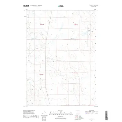
2017 Map of The Gap SW
USGS Topo · Published 2017About this map
Caballo Creek and its namesake tributary Caballo Cr wind through this high-plains landscape in Campbell County. The drainage network is further defined by seasonal watercourses like Bone Pile Cr and the eastern Clabaugh Draw, illustrating the arid hydrology of the Powder River Basin. Man-made interventions are sparse but critical, anchored by the Haight Reservoir in the southwest. A grid of rural routes including Hilight Rd and Bishop Rd provides access to large-tract ranching and resource land, connecting the various draws and creek beds that break up the open terrain. The map details the precise township and range boundaries that govern this expansive territory, such as t48n r72w and t47n r71w, revealing the systematic organization of the Wyoming backcountry during the late twentieth and early twenty-first centuries.
Find a feature on this map
17 named features on this map. Tap any name to fly to it.
Don’t see what you’re looking for? This feature index may not catch every label — zoom into the map to look around manually.
Map Details
Editions of this 2017 The Gap SW Map
This is the sole edition of this map. No revisions or reprints were ever made.
Other maps of this area

1954 · Gillette
USGS Topo · 1:250,000

1955 · Newcastle
USGS Topo · 1:250,000

1955 · Gillette
USGS Topo · 1:250,000

1958 · Gillette
USGS Topo · 1:250,000

1958 · Newcastle
USGS Topo · 1:250,000

1959 · North Star School
USGS Topo · 1:62,500

1962 · Gillette
USGS Topo · 1:250,000

1971 · Scaper Reservoir
USGS Topo · 1:24,000

1971 · Coyote Draw
USGS Topo · 1:24,000

1971 · The Gap SW
USGS Topo · 1:24,000