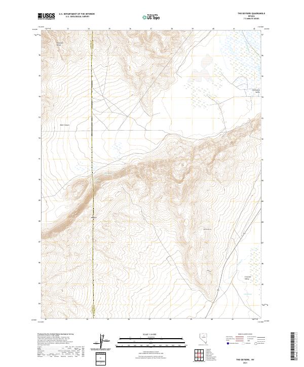
2021 Map of The Geysers
USGS Topo · Published 2021About this map
The Shoshone Range dominates the western portion of this terrain, where the boundary between Lander and Eureka Counties follows the high ridges. This high-desert landscape is defined by its geothermal and hydrologic features, most notably the cluster of The Geysers and Hot Springs situated near the center of the quadrangle. These natural thermal vents are positioned between the volcanic formations of Malpais and the deep cut of Mule Canyon. To the east, the elevation drops into the expansive Whirlwind Valley and Crescent Valley, where drainages like Coyote Cr and Cold Springs collect. Though largely open range, localized human activity is represented by Bird Ranch Rd and a site labeled Panning, suggesting the area's long-standing connection to mineral exploration and ranching.
Find a feature on this map
20 named features on this map. Tap any name to fly to it.
Don’t see what you’re looking for? This feature index may not catch every label — zoom into the map to look around manually.
Map Details
Editions of this 2021 The Geysers Map
This is the sole edition of this map. No revisions or reprints were ever made.
Other maps of this area

1949 · Crescent Valley
USGS Topo · 1:62,500

1950 · Crescent Valley
USGS Topo · 1:62,500

1955 · Winnemucca
USGS Topo · 1:250,000

1957 · Frenchie Creek
USGS Topo · 1:62,500

1957 · Dunphy
USGS Topo · 1:62,500

1957 · Beowawe
USGS Topo · 1:62,500

1958 · Winnemucca
USGS Topo · 1:250,000

1962 · Winnemucca
USGS Topo · 1:250,000

1985 · Mud Spring Gulch
USGS Topo · 1:24,000
1985 · Crescent Valley
USGS Topo · 1:24,000