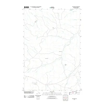
2011 Map of The Knob
USGS Topo · Published 2011About this map
The Pine Hills dominate this section of Custer County, defining a landscape marked by complex drainage systems and isolated water sources. As recorded in 2011, the area relies on a network of named springs and small-scale water management, including Ice Cave Spring, Knob Spring, and the Sundial Dam along Dixon Creek. These features illustrate the vital role of water in the Montana high country, where seasonal flows across Black Canyon and along Cottonwood Creek shape the local geography.
Find a feature on this map
25 named features on this map. Tap any name to fly to it.
Don’t see what you’re looking for? This feature index may not catch every label — zoom into the map to look around manually.
Map Details
Editions of this 2011 The Knob Map
This is the sole edition of this map. No revisions or reprints were ever made.
Other maps of this area

1953 · Miles City
USGS Topo · 1:250,000

1957 · Miles City
USGS Topo · 1:250,000

1958 · Miles City
USGS Topo · 1:250,000

1969 · Corral Butte
USGS Topo · 1:24,000

1969 · Haines Springs
USGS Topo · 1:24,000

1969 · Kinsey
USGS Topo · 1:24,000

1969 · Government Hill
USGS Topo · 1:24,000

1969 · The Knob
USGS Topo · 1:24,000

1969 · Buck Mountain
USGS Topo · 1:24,000
1969 · Whitney Creek
USGS Topo · 1:24,000