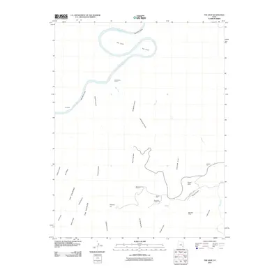
2010 Map of The Loop
USGS Topo · Published 2010About this map
Colorado River carving through the heart of Canyonlands National Park defines this landscape, particularly at the dramatic oxbow known as The Loop. This 2010 survey illustrates a complex geological environment where Meander Canyon and The Slide meet a network of dry washes and high plateaus. To the south, the intricate topography of The Needles and The Grabens transitions into named formations like Wooden Shoe and Elephant Hill. Human activity is concentrated around backcountry infrastructure, including the Squaw Flat Campground and various viewpoints such as Colorado River Overlook and Big Spring Canyon Overlook. The presence of Roadside Ruin and Cave Spring points to a deep history of habitation in this arid corridor. The map effectively documents the intersection of natural erosional features and the established trail and road network that provides access to Squaw Flat and Lost Canyon.
Find a feature on this map
33 named features on this map. Tap any name to fly to it.
Don’t see what you’re looking for? This feature index may not catch every label — zoom into the map to look around manually.
Map Details
Editions of this 2010 The Loop Map
This is the sole edition of this map. No revisions or reprints were ever made.
Other maps of this area

1885 · La Sal
USGS Topo · 1:250,000

1951 · Upheaval Dome
USGS Topo · 1:62,500

1952 · Carlisle 2 SE
USGS Topo · 1:24,000

1952 · Carlisle 2 SW
USGS Topo · 1:24,000

1953 · Carlisle 3 NW
USGS Topo · 1:24,000

1953 · The Needles
USGS Topo · 1:62,500

1954 · Carlisle 4 SW
USGS Topo · 1:24,000

1954 · Carlisle 4 NW
USGS Topo · 1:24,000

1954 · Carlisle 1 SW
USGS Topo · 1:24,000
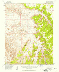
1954 · Harts Point
USGS Topo · 1:62,500