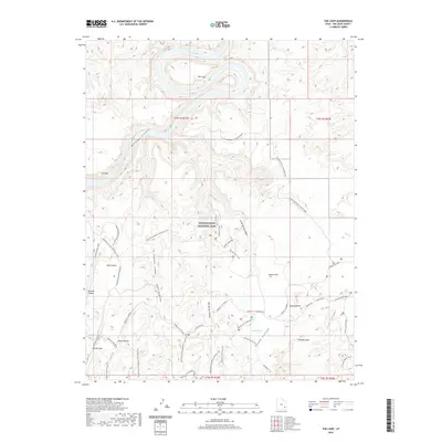
2020 Map of The Loop
USGS Topo · Published 2020About this map
The Loop dominates this section of the Colorado River, where the watercarved landscape of Canyonlands National Park creates a series of intricate plateaus and deep drainages. The transition from the high desert overlooks to the river bottom is documented through a dense network of specialized routes, including the Colorado River Overlook Road and the Confluence Overlook Road. These paths navigate around significant landforms such as Elephant Hill and Squaw Butte, highlighting how the natural geology dictates movement through the terrain.
Find a feature on this map
46 named features on this map. Tap any name to fly to it.
Don’t see what you’re looking for? This feature index may not catch every label — zoom into the map to look around manually.
Map Details
Editions of this 2020 The Loop Map
This is the sole edition of this map. No revisions or reprints were ever made.
Other maps of this area

1885 · La Sal
USGS Topo · 1:250,000

1951 · Upheaval Dome
USGS Topo · 1:62,500

1952 · Carlisle 2 SE
USGS Topo · 1:24,000

1952 · Carlisle 2 SW
USGS Topo · 1:24,000

1953 · Carlisle 3 NW
USGS Topo · 1:24,000

1953 · The Needles
USGS Topo · 1:62,500

1954 · Carlisle 4 SW
USGS Topo · 1:24,000

1954 · Carlisle 4 NW
USGS Topo · 1:24,000

1954 · Carlisle 1 SW
USGS Topo · 1:24,000
1954 · Harts Point
USGS Topo · 1:62,500