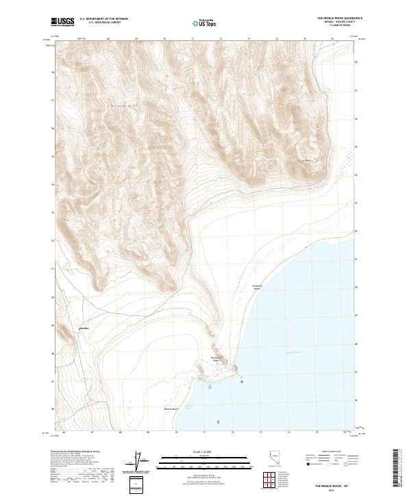
2021 Map of The Needle Rocks
USGS Topo · Published 2021About this map
Pyramid Lake dominates the eastern edge of this landscape, its shoreline defined by unique geothermal and geological markers. The prominent shoreline formation known as The Needle Rocks sits adjacent to a Steam Geyser and multiple Hot Springs, signaling the active hydrothermal systems present in this corner of Washoe County. The western terrain is characterized by the Terraced Hills, where steep contouring rises from the lake basin toward high desert ridges.
Find a feature on this map
17 named features on this map. Tap any name to fly to it.
Don’t see what you’re looking for? This feature index may not catch every label — zoom into the map to look around manually.
Map Details
Editions of this 2021 The Needle Rocks Map
This is the sole edition of this map. No revisions or reprints were ever made.
Other maps of this area

1886 · Granite Range
USGS Topo · 1:250,000

1894 · Granite Range
USGS Topo · 1:250,000

1955 · Lovelock
USGS Topo · 1:250,000

1959 · Lovelock
USGS Topo · 1:250,000

1964 · The Needle Rocks
USGS Topo · 1:24,000
1964 · Pyramid SW
USGS Topo · 1:24,000
1964 · Astor Pass
USGS Topo · 1:24,000

1964 · Pyramid NE
USGS Topo · 1:24,000
1964 · Spanish Flat
USGS Topo · 1:24,000

1965 · Fox Range
USGS Topo · 1:62,500