
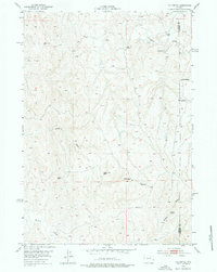
1953 Map of The Nipple
USGS Topo · Published 1954About this map
The Nipple rises as a prominent landmark in this 1953 survey of the Wyoming cattle country, a landscape shaped by intermittent drainages and the essential search for water. Jointly produced with the United States Atomic Energy Commission, the map documents a period when the high plains were scrutinized for both grazing potential and mineral resources. The human presence is marked by isolated outposts like the Dobrenz Ranch (Aban'd) and Wilson Ranch (Aban'd), both noted as abandoned by the early 1950s. These former homesteads are situated near vital water sources such as School Section Spring and an Artesian Well, illustrating the precarious nature of ranching in the Powder River Basin. The intricate topography of Windmill Draw and Willow Creek reveals the natural corridors used for movement across the Johnson and Campbell County line.
Find a feature on this map
11 named features on this map. Tap any name to fly to it.
Don’t see what you’re looking for? This feature index may not catch every label — zoom into the map to look around manually.
Map Details
Editions of this 1953 The Nipple Map
2 editions found
Other maps of this area

1953 · Hoe Ranch
USGS Topo · 1:24,000

1953 · Fort Reno
USGS Topo · 1:24,000

1953 · Fort Reno SE
USGS Topo · 1:24,000

1953 · Fats Draw
USGS Topo · 1:24,000

1953 · North Butte
USGS Topo · 1:24,000

1954 · Gillette
USGS Topo · 1:250,000

1955 · Newcastle
USGS Topo · 1:250,000

1955 · Sheridan
USGS Topo · 1:250,000

1955 · Arminto
USGS Topo · 1:250,000

1955 · Gillette
USGS Topo · 1:250,000