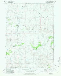
1982 Map of The Nose West
USGS Topo · Published 1982About this map
The Hampshire (Site) occupies a central position in this high-plains landscape, where the confluence of several vital watercourses dictated the early movement of people and industry. During the early 1980s, the terrain was characterized by a network of drainage systems including Thunder Creek, Wildcat Creek, and the meandering Cheyenne River. The map reveals an active energy landscape, with numerous Oil Wells and Drill Holes scattered across the northern sections and concentrated within Black Field. This extraction activity is supported by a rugged transit network of named arteries like Dull Center Road, Grieves Road, and Clareton Road, which connect isolated sites across the Weston and Niobrara county line. Distinctive landforms such as The Nose and deep incisions like Graham Draw provide a clear topographic picture of this Wyoming energy frontier.
Find a feature on this map
16 named features on this map. Tap any name to fly to it.
Don’t see what you’re looking for? This feature index may not catch every label — zoom into the map to look around manually.
Map Details
Editions of this 1982 The Nose West Map
This is the sole edition of this map. No revisions or reprints were ever made.
Other maps of this area

1955 · Newcastle
USGS Topo · 1:250,000

1958 · Newcastle
USGS Topo · 1:250,000

1979 · Newcastle
USGS Topo · 1:100,000

1981 · Horseshoe Bend
USGS Topo · 1:24,000

1981 · Garland Draw
USGS Topo · 1:24,000

1981 · Wagonhound Creek NE
USGS Topo · 1:24,000

1981 · Lance Creek
USGS Topo · 1:100,000
1982 · Poddy Creek
USGS Topo · 1:24,000

1982 · Clareton
USGS Topo · 1:24,000
1982 · The Nose East
USGS Topo · 1:24,000