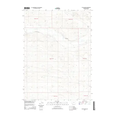
2015 Map of The Palisades
USGS Topo · Published 2015About this map
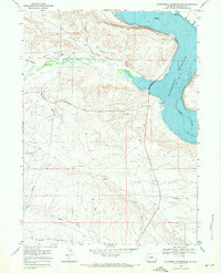
The Palisades rises as a prominent landmark in this high-desert landscape of Lincoln County, where the topography is defined by the erosion of multiple drainage systems. The northern reaches are shaped by Fontenelle Cr, with Fontenelle Creek Rd and CR-314 providing the primary access through the drainage basin. To the south, the terrain becomes a series of parallel ridges and valleys carved by Willow Cr, Sheep Cr, and Jackson Cr. This map documents a remote section of Wyoming where the land is largely organized by the Public Land Survey System, shown through the grid of townships such as t24n r114w and t25n r113w. Aside from the designated county roads and seasonal creek beds like Dry Hollow, the area remains sparsely developed, reflecting the vast open-range character of the Green River Basin's periphery.
Find a feature on this map
14 named features on this map. Tap any name to fly to it.
Don’t see what you’re looking for? This feature index may not catch every label — zoom into the map to look around manually.
Map Details
Editions of this 2015 The Palisades Map
This is the sole edition of this map. No revisions or reprints were ever made.
Other maps of this area
1945 · Fort Hill
USGS Topo · 1:62,500
1947 · Fort Hill
USGS Topo · 1:62,500

1954 · Ogden
USGS Topo · 1:250,000

1955 · Preston
USGS Topo · 1:250,000

1958 · Ogden
USGS Topo · 1:250,000

1958 · Preston
USGS Topo · 1:250,000

1960 · Ogden
USGS Topo · 1:250,000

1962 · Preston
USGS Topo · 1:250,000
1968 · Names Hill
USGS Topo · 1:24,000
1968 · Fontenelle Reservoir SW
USGS Topo · 1:24,000