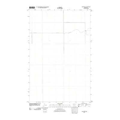
2010 Map of The Pines
USGS Topo · Published 2010About this map
The Pines sits in the northeast corner of this Koochiching County landscape, a small settlement area amidst the expansive north woods of Minnesota. The map illustrates a remote infrastructure pattern defined by long, straight jurisdictional boundaries and utility corridors, such as the Kooc 16 Border and Kooc 14 Border. Transport in the region is anchored by a network of rural roads including County Hwy-82 and County Hwy-122, which provide the primary access to the scattered clearings and homesteads. The naming of Indian Pines Rd reflects the local timber and landscape character of this borderland territory. This 2010 edition serves as a clear record of the modern rural road grid and land divisions in a sparsely populated section of the state before further contemporary development.
Find a feature on this map
6 named features on this map. Tap any name to fly to it.
Don’t see what you’re looking for? This feature index may not catch every label — zoom into the map to look around manually.
Map Details
Editions of this 2010 The Pines Map
This is the sole edition of this map. No revisions or reprints were ever made.
Other maps of this area

1919 · Knutson
USGS Topo · 1:62,500

1921 · Baudette
USGS Topo · 1:62,500

1954 · Roseau
USGS Topo · 1:250,000

1957 · Roseau
USGS Topo · 1:250,000

1958 · Roseau
USGS Topo · 1:250,000

1968 · Baudette SE
USGS Topo · 1:24,000

1968 · Clementson SW
USGS Topo · 1:24,000

1968 · Clementson SE
USGS Topo · 1:24,000
1973 · Ludlow Lookout Tower
USGS Topo · 1:24,000
1973 · Wayland SW
USGS Topo · 1:24,000