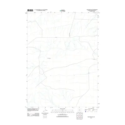
2012 Map of The Pinnacles
USGS Topo · Published 2012About this map
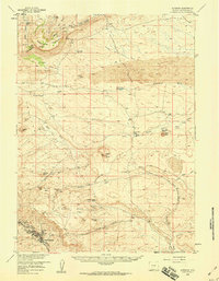
The Pinnacles rise as a prominent geological landmark in this remote corner of Sweetwater County, anchoring a high-desert landscape defined by sparse drainage and intermittent water sources. The small, localized settlement at Bar X Ranch stands as the primary human footprint in an area otherwise dedicated to cattle range and open territory. The hydrology of the quadrangle is largely seasonal, evidenced by the winding path of Bush Cr in the northern reaches, which serves as a vital artery in this arid environment. Transportation through the region relies on a network of unpaved desert tracks, including Bar X Rd and Oregon Buttes Rd, which trace the low-lying ridges and provide access across the wide-open basins. A lonely stretch of 9 Mile Rd cuts through the eastern portion of the sheet, illustrating the expansive, isolated nature of Wyoming's grazing lands during the early twenty-first century.
Find a feature on this map
6 named features on this map. Tap any name to fly to it.
Don’t see what you’re looking for? This feature index may not catch every label — zoom into the map to look around manually.
Map Details
Editions of this 2012 The Pinnacles Map
This is the sole edition of this map. No revisions or reprints were ever made.
Other maps of this area

1954 · Rock Springs
USGS Topo · 1:250,000

1955 · Lander
USGS Topo · 1:250,000

1958 · Lander
USGS Topo · 1:250,000

1958 · Rock Springs
USGS Topo · 1:250,000
1958 · Twelvemile Well
USGS Topo · 1:62,500
1958 · Freighter Gap
USGS Topo · 1:62,500
1958 · The Pinnacles
USGS Topo · 1:62,500
1958 · Superior
USGS Topo · 1:62,500

1961 · Lander
USGS Topo · 1:250,000

1962 · Rock Springs
USGS Topo · 1:250,000