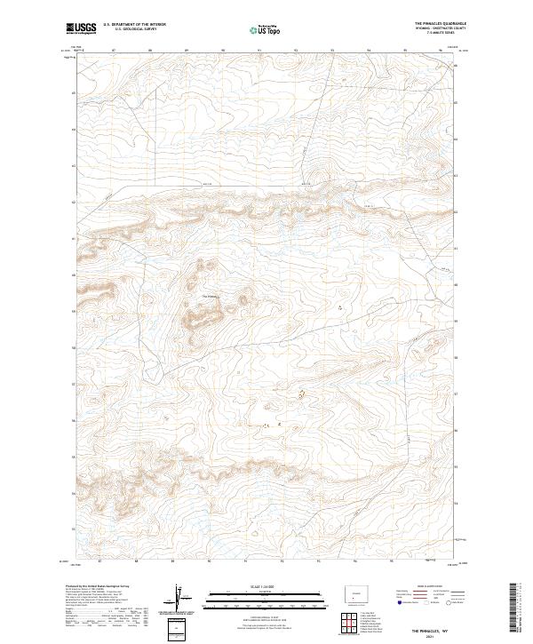
2021 Map of The Pinnacles
USGS Topo · Published 2021About this map
The Pinnacles stand as the defining landform of this high-elevation Wyoming landscape within Sweetwater County. The terrain is characterized by intricate contouring that reveals a network of ridges and drainages, most notably Bush Cr. which flows through the northwestern corner. This area is defined by its isolation and the systematic grid of the Public Land Survey System, with boundaries such as t24n r100w and t25n r99w marking the vast ranching or mineral tracts typical of the region. Human presence is limited to a sparse network of unpaved transit routes, including Bar X Rd, Co Rd 74, and Co Rd 15, which navigate the elevation changes between the namesake rock formations and the creek beds.
Find a feature on this map
11 named features on this map. Tap any name to fly to it.
Don’t see what you’re looking for? This feature index may not catch every label — zoom into the map to look around manually.
Map Details
Editions of this 2021 The Pinnacles Map
This is the sole edition of this map. No revisions or reprints were ever made.
Other maps of this area

1954 · Rock Springs
USGS Topo · 1:250,000

1955 · Lander
USGS Topo · 1:250,000

1958 · Lander
USGS Topo · 1:250,000

1958 · Rock Springs
USGS Topo · 1:250,000

1958 · Twelvemile Well
USGS Topo · 1:62,500

1958 · Freighter Gap
USGS Topo · 1:62,500

1958 · The Pinnacles
USGS Topo · 1:62,500

1958 · Superior
USGS Topo · 1:62,500

1961 · Lander
USGS Topo · 1:250,000

1962 · Rock Springs
USGS Topo · 1:250,000