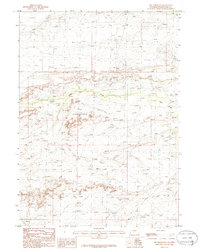
1986 Map of The Pinnacles
USGS Topo · Published 1986About this map
The Pinnacles dominate this high-desert landscape in southwestern Wyoming, where jagged terrain features drop toward the winding depression of Alkali Draw. Surveyed in the early 1980s, the map reveals a remote and arid expanse characterized by deep basins and seasonal drainages. The Alkali Basin occupies the eastern portion of the sheet, while Bush Creek carves a narrow path in the north. This 1986 provisional edition captures the topography of Sweetwater County as it existed prior to extensive modern development, noting only essential landmarks such as a lone Well near the basin. The scarcity of named human settlements emphasizes the isolation of this corner of the state, where the natural geology remains the primary focus for researchers and explorers.
Find a feature on this map
5 named features on this map. Tap any name to fly to it.
Don’t see what you’re looking for? This feature index may not catch every label — zoom into the map to look around manually.
Map Details
Editions of this 1986 The Pinnacles Map
This is the sole edition of this map. No revisions or reprints were ever made.
Other maps of this area

1954 · Rock Springs
USGS Topo · 1:250,000

1955 · Lander
USGS Topo · 1:250,000

1958 · Lander
USGS Topo · 1:250,000

1958 · Rock Springs
USGS Topo · 1:250,000

1958 · Twelvemile Well
USGS Topo · 1:62,500

1958 · Freighter Gap
USGS Topo · 1:62,500

1958 · The Pinnacles
USGS Topo · 1:62,500

1958 · Superior
USGS Topo · 1:62,500

1961 · Lander
USGS Topo · 1:250,000

1962 · Rock Springs
USGS Topo · 1:250,000