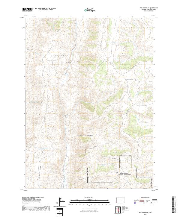
2021 Map of The Rock Slide
USGS Topo · Published 2021About this map
Fossil Butte National Monument occupies the southeastern corner of this map, protecting a prehistoric landscape defined by steep ridges and canyons. The Tunp Range and Dempsey Ridge dominate the central terrain, separated by narrow watercourses like Little Beaver Cr and Rock Creek. The geography here preserves a network of historical waypoints, most notably Emigrant Spring and the named geological feature The Rock Slide. Local travel is marked by ranching and resource roads such as Farm Field Rd and Co Rd 209, which navigate the elevation changes between Schuster Basin and Millet Canyon. This 2021 survey details the complex drainage systems of the High Desert, tracing numerous forks and creeks that flow from Rock Creek Ridge toward the canyon floors.
Find a feature on this map
30 named features on this map. Tap any name to fly to it.
Don’t see what you’re looking for? This feature index may not catch every label — zoom into the map to look around manually.
Map Details
Editions of this 2021 The Rock Slide Map
This is the sole edition of this map. No revisions or reprints were ever made.
Other maps of this area

1936 · Cokeville
USGS Topo · 1:96,000

1942 · Cokeville
USGS Topo · 1:125,000

1954 · Sage
USGS Topo · 1:62,500

1954 · Ogden
USGS Topo · 1:250,000

1954 · Kemmerer
USGS Topo · 1:62,500

1955 · Preston
USGS Topo · 1:250,000

1958 · Ogden
USGS Topo · 1:250,000

1958 · Preston
USGS Topo · 1:250,000

1960 · Ogden
USGS Topo · 1:250,000

1962 · Preston
USGS Topo · 1:250,000