1987 Map of The Rockies
USGS Topo · Published 1987About this map
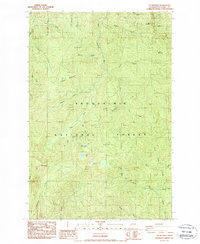
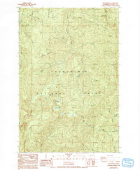
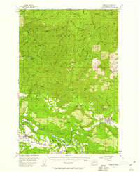
The Rockies provides the namesake high point for this interior mountain region of Washington in the late 1980s. This survey area is defined by the headwaters of several significant drainage systems, including the Deschutes River and Little Nisqually River to the north, and the Tilton River flowing across the southern sections. The landscape is heavily characteristic of industrial forestry management within the Snoqualmie National Forest and Gifford Pinchot National Forest, marked by numerous Borrow Pit and Quarry sites used for maintenance of the extensive timber road network. Small alpine water bodies like Goose Lake and Duck Lake sit among high peaks such as Stahl Mountain and Ladd Mountain, while human access is indicated by isolated Gate markers and a network of 4WD tracks.
Find a feature on this map
39 named features on this map. Tap any name to fly to it.
Don’t see what you’re looking for? This feature index may not catch every label — zoom into the map to look around manually.
Map Details
Editions of this 1987 The Rockies Map
2 editions found
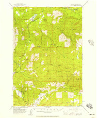
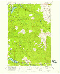
Other maps of this area

1937 · Eatonville
USGS Topo · 1:125,000

1941 · Tanwax Lake
USGS Topo · 1:62,500

1944 · Ohop Valley
USGS Topo · 1:62,500

1949 · Ohop Valley
USGS Topo · 1:62,500

1953 · Hoquiam
USGS Topo · 1:250,000
1956 · Mineral
USGS Topo · 1:62,500
1956 · Kapowsin
USGS Topo · 1:62,500

1957 · Hoquiam
USGS Topo · 1:250,000
1957 · Morton
USGS Topo · 1:62,500

1958 · Hoquiam
USGS Topo · 1:250,000