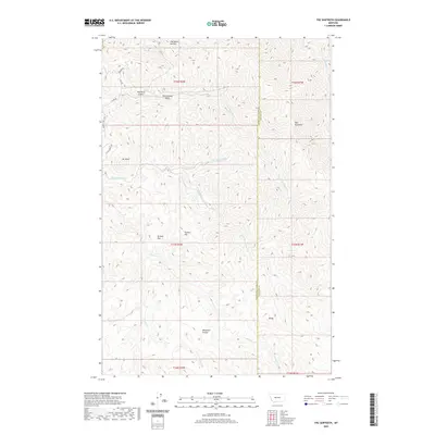
2020 Map of The Sawteeth
USGS Topo · Published 2020About this map
The Sawteeth rises prominently along the border of Cascade and Lewis and Clark Counties, defining a landscape of sharp ridges and deep drainage basins. This 2020 topographic survey shows a high-elevation backcountry characterized by descriptive local landmarks like The Devils Kitchen and The Painted Rock. The drainage network is complex, with the N Fork Stickney Cr and Little Stickney Cr carving through the terrain toward Browns Flat. Higher elevations are marked by distinct peaks including Mt Rowe and the Twin Sisters, while more level clearings like Whitetail Prairie and Browns Flat suggest breaks in the steep topography. Human presence is sparse, represented primarily by a small network of service roads such as Cox Ln and Werner Dr that skirt the edges of the mountainous core.
Find a feature on this map
29 named features on this map. Tap any name to fly to it.
Don’t see what you’re looking for? This feature index may not catch every label — zoom into the map to look around manually.
Map Details
Editions of this 2020 The Sawteeth Map
This is the sole edition of this map. No revisions or reprints were ever made.
Other maps of this area
1886 · Great Falls
USGS Topo · 1:250,000
1886 · Fort Logan
USGS Topo · 1:250,000
1948 · White Sulphur Springs
USGS Topo · 1:250,000

1954 · Great Falls
USGS Topo · 1:250,000
1957 · Great Falls
USGS Topo · 1:250,000
1958 · White Sulphur Springs
USGS Topo · 1:250,000
1961 · White Sulphur Springs
USGS Topo · 1:250,000
1961 · Craig
USGS Topo · 1:24,000
1961 · Hardy
USGS Topo · 1:24,000
1961 · Hound Creek Reservoir
USGS Topo · 1:24,000