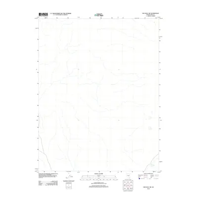
2012 Map of The Wall SW
USGS Topo · Published 2012About this map
Nye County's high desert landscape is documented here by the U.S. Geological Survey in the early 21st century. This arid terrain is defined by its sparse water infrastructure, centered on the Stone Corral Well Reservoir in the southeastern corner. The map illustrates a network of drainage patterns and intermittent watercourses typical of the Great Basin, where seasonal runoff from the surrounding ranges is carefully managed for ranching or resource needs. The presence of the reservoir suggests a localized point of activity or utility within an otherwise open and undeveloped expanse of the Nevada interior.
Find a feature on this map
1 named feature on this map. Tap any name to fly to it.
Don’t see what you’re looking for? This feature index may not catch every label — zoom into the map to look around manually.
Map Details
Editions of this 2012 The Wall SW Map
This is the sole edition of this map. No revisions or reprints were ever made.
Other maps of this area

1956 · Lund
USGS Topo · 1:250,000

1956 · Tonopah
USGS Topo · 1:250,000

1959 · Tonopah
USGS Topo · 1:250,000

1960 · Lund
USGS Topo · 1:250,000

1962 · Tonopah
USGS Topo · 1:250,000
1967 · Lunar Crater
USGS Topo · 1:62,500
1967 · Lunar Crater
USGS Topo · 1:24,000
1967 · Chuck Wagon Flat
USGS Topo · 1:24,000
1968 · Reveille
USGS Topo · 1:62,500
1968 · The Wall
USGS Topo · 1:62,500