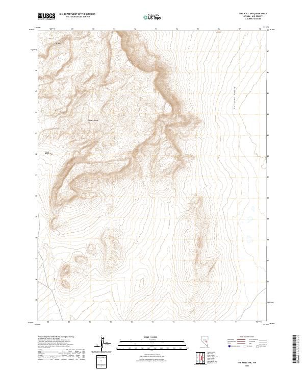
2021 Map of The Wall SW
USGS Topo · Published 2021About this map
The high-desert terrain of the Pancake Range dominates this quadrangle, defining a rugged divide between two significant Nevada basins. Along the western edge, the land drops into the broad expanse of Chuck Wagon Flat, while the eastern portion of the sheet descends into the vast Railroad Valley. A prominent topographic feature known simply as The Wall stands as a steep escarpment in the northwestern corner, illustrating the dramatic uplift characteristic of the Basin and Range Province. This 2021 survey details the complex network of section lines and township boundaries, such as t6n r53e and t5n r54e, which overlay a landscape of alluvial fans and arid valleys. The absence of modern infrastructure underscores the isolation of this Nye County region, where the topography itself remains the primary landmark for those navigating this remote corner of the Great Basin.
Find a feature on this map
8 named features on this map. Tap any name to fly to it.
Don’t see what you’re looking for? This feature index may not catch every label — zoom into the map to look around manually.
Map Details
Editions of this 2021 The Wall SW Map
This is the sole edition of this map. No revisions or reprints were ever made.
Other maps of this area

1956 · Lund
USGS Topo · 1:250,000

1956 · Tonopah
USGS Topo · 1:250,000

1959 · Tonopah
USGS Topo · 1:250,000

1960 · Lund
USGS Topo · 1:250,000

1962 · Tonopah
USGS Topo · 1:250,000

1967 · Lunar Crater
USGS Topo · 1:62,500

1967 · Lunar Crater
USGS Topo · 1:24,000
1967 · Chuck Wagon Flat
USGS Topo · 1:24,000
1968 · Reveille
USGS Topo · 1:62,500

1968 · The Wall
USGS Topo · 1:62,500