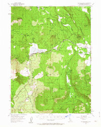
1954 Map of The Whaleback
USGS Topo · Published 1963About this map
Volcanic peaks and timber industry operations dominate this 1950s landscape in the southern reaches of Butte Valley. The map centers on the massive volcanic shield of The Whaleback and the high summit of Deer Mtn, surrounded by the protected lands of the Klamath National Forest and Shasta National Forest. Transportation through these mountain passes relied on the Southern Pacific line and an extensive network of timber-related infrastructure, including the Logging RR and several specialized sidings.
Find a feature on this map
57 named features on this map. Tap any name to fly to it.
Don’t see what you’re looking for? This feature index may not catch every label — zoom into the map to look around manually.
Map Details
Editions of this 1954 The Whaleback Map
3 editions found

Other maps of this area

1886 · Modoc Lava Bed
USGS Topo · 1:250,000

1886 · Shasta
USGS Topo · 1:250,000

1892 · Modoc Lava-Bed
USGS Topo · 1:250,000

1894 · Shasta
USGS Topo · 1:250,000

1922 · Shasta Valley Sheet No 10 E
USGS Topo · 1:24,000

1932 · Bartle
USGS Topo · 1:96,000

1934 · Macdoel
USGS Topo · 1:96,000

1935 · Dunsmuir
USGS Topo · 1:125,000

1939 · Bartle
USGS Topo · 1:125,000

1941 · Macdoel
USGS Topo · 1:125,000