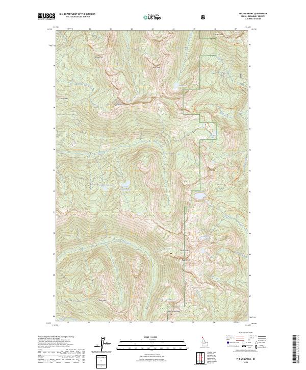
2024 Map of The Wigwams
USGS Topo · Published 2024About this map
Kaniksu National Forest defines this high-elevation landscape in Boundary County, where a network of trails connects remote alpine basins and granite summits. This 2024 topographic survey focuses on the Selkirk Mountains, revealing a terrain shaped by water and ice. High-country drainage systems include Lion Creek and the Pack River, which are fed by numerous small mountain lakes like Two Mouth Lakes and Beehive Lakes.
Find a feature on this map
38 named features on this map. Tap any name to fly to it.
Don’t see what you’re looking for? This feature index may not catch every label — zoom into the map to look around manually.
Map Details
Editions of this 2024 The Wigwams Map
This is the sole edition of this map. No revisions or reprints were ever made.
Other maps of this area

1911 · Priest Lake
USGS Topo · 1:250,000

1913 · Priest Lake
USGS Topo · 1:250,000

1958 · Sandpoint
USGS Topo · 1:250,000

1963 · Sandpoint
USGS Topo · 1:250,000

1967 · Priest Lake SE
USGS Topo · 1:24,000

1967 · Priest Lake NE
USGS Topo · 1:24,000

1967 · The Wigwams
USGS Topo · 1:24,000
1967 · Roman Nose
USGS Topo · 1:24,000

1967 · Mount Roothaan
USGS Topo · 1:24,000
1967 · Dodge Peak
USGS Topo · 1:24,000