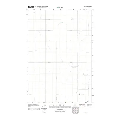
2011 Map of Thelan
USGS Topo · Published 2011About this map
Rocky Butte rises as a prominent landmark in this corner of Golden Valley County, overlooking a landscape defined by the drainage of Garner Creek and its northern tributaries. The high plains terrain is partitioned by a grid of rural sections, with the small settlements of Thelan and Ekre situated along the western transit corridor. Water management in this semi-arid environment is evidenced by the Bosserman Dam, which captures runoff along the creek's path.
Find a feature on this map
22 named features on this map. Tap any name to fly to it.
Don’t see what you’re looking for? This feature index may not catch every label — zoom into the map to look around manually.
Map Details
Editions of this 2011 Thelan Map
This is the sole edition of this map. No revisions or reprints were ever made.
Other maps of this area

1953 · Miles City
USGS Topo · 1:250,000

1953 · Dickinson
USGS Topo · 1:250,000

1957 · Dickinson
USGS Topo · 1:250,000

1957 · Miles City
USGS Topo · 1:250,000

1958 · Miles City
USGS Topo · 1:250,000

1979 · Sentinel Butte SE
USGS Topo · 1:24,000

1980 · Golva
USGS Topo · 1:24,000
1980 · Beach East
USGS Topo · 1:24,000
1980 · Sentinel Butte
USGS Topo · 1:24,000

1980 · Thelan
USGS Topo · 1:24,000