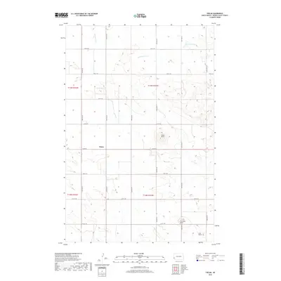
2018 Map of Thelan
USGS Topo · Published 2018About this map
Thelan sits at the heart of this rural landscape in Golden Valley County, marking a focal point for the section-line road network of Beach Township. The terrain is defined by isolated elevations such as Rocky Butte and Five Point Butte, which rise above the surrounding drainage basins of the Little Beaver Cr and N Fork Garner Cr. The map reveals a strictly organized agricultural grid, where long avenues like 164th Ave SW and 167th Ave SW intersect with numbered streets and Thelen Rd. These rectilinear paths dictate the movement of people and commerce across the North Dakota prairie, following the established township and range system. To the southeast, Lone Butte stands near the edge of the Garner Cr watershed, illustrating the subtle but significant topography that characterizes this part of the Great Plains.
Find a feature on this map
25 named features on this map. Tap any name to fly to it.
Don’t see what you’re looking for? This feature index may not catch every label — zoom into the map to look around manually.
Map Details
Editions of this 2018 Thelan Map
This is the sole edition of this map. No revisions or reprints were ever made.
Other maps of this area

1953 · Miles City
USGS Topo · 1:250,000

1953 · Dickinson
USGS Topo · 1:250,000

1957 · Dickinson
USGS Topo · 1:250,000

1957 · Miles City
USGS Topo · 1:250,000

1958 · Miles City
USGS Topo · 1:250,000

1979 · Sentinel Butte SE
USGS Topo · 1:24,000

1980 · Golva
USGS Topo · 1:24,000
1980 · Beach East
USGS Topo · 1:24,000
1980 · Sentinel Butte
USGS Topo · 1:24,000

1980 · Thelan
USGS Topo · 1:24,000