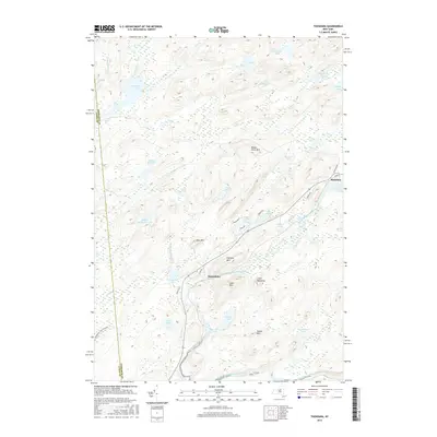
2016 Map of Thendara
USGS Topo · Published 2016About this map
The Adirondack Park Preserve defines this landscape in Herkimer County, where the village of Thendara serves as a gateway to a dense network of water bodies and high peaks. The geography is dominated by the winding course of the Middle Branch Moose River, which flows past the settlement of Minnehaha. This 2016 survey illustrates the modern road network, including Old Rte 28 and specialized local routes like Okara Rd W and Okara Rd E.
Find a feature on this map
52 named features on this map. Tap any name to fly to it.
Don’t see what you’re looking for? This feature index may not catch every label — zoom into the map to look around manually.
Map Details
Editions of this 2016 Thendara Map
This is the sole edition of this map. No revisions or reprints were ever made.
Other maps of this area

1901 · Old Forge
USGS Topo · 1:62,500

1903 · Big Moose
USGS Topo · 1:62,500

1912 · Number Four
USGS Topo · 1:62,500

1912 · Mc Keever
USGS Topo · 1:62,500

1915 · Number Four
USGS Topo · 1:62,500

1950 · Utica
USGS Topo · 1:250,000

1954 · Old Forge
USGS Topo · 1:62,500

1954 · Big Moose
USGS Topo · 1:62,500

1957 · Utica
USGS Topo · 1:250,000
1957 · Number Four
USGS Topo · 1:62,500