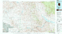
1994 Map of Theodore Roosevelt Lake
USGS Topo · Published 1995About this map
Theodore Roosevelt Lake anchors this complex desert and mountain geography, marking the eastern boundary of a massive water management system that follows the Salt River and Tonto Creek. The map documents the sprawling urban edges of Phoenix, Scottsdale, and Paradise Valley as they meet the McDowell Mountain foothills in the mid-1990s. Further north, the planned communities of Carefree and Cave Creek sit near the transition to the protected wilderness of the Tonto National Forest.
Find a feature on this map
39 named features on this map. Tap any name to fly to it.
Don’t see what you’re looking for? This feature index may not catch every label — zoom into the map to look around manually.
Map Details
Editions of this 1994 Theodore Roosevelt Lake Map
3 editions found
Other maps of this area

1886 · Holbrook
USGS Topo · 1:250,000

1887 · Verde
USGS Topo · 1:250,000

1887 · Prescott
USGS Topo · 1:250,000

1892 · Verde
USGS Topo · 1:250,000

1892 · Prescott
USGS Topo · 1:250,000

1893 · Holbrook
USGS Topo · 1:250,000

1900 · Florence
USGS Topo · 1:125,000

1901 · Globe
USGS Topo · 1:62,500

1902 · Globe
USGS Topo · 1:62,500

1902 · Florence
USGS Topo · 1:125,000