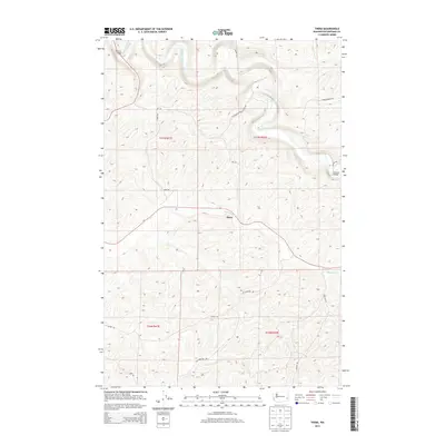
2013 Map of Thera
USGS Topo · Published 2013About this map
The Palouse River winds through the northern reaches of this Whitman County landscape, carving deep contours into the plateau. In the central portion of the map, the small settlement of Thera sits near the banks of Rebel Flat Cr, a significant watercourse that cuts across the terrain from east to west. This area is defined by a dense network of country roads named for local families and early residents, including Ed Hamilton Rd, Frank Feenan Rd, and Ochs Rd, which provide access to the high-relief agricultural lands. Essential river crossings are established at Matlock Bridge in the northwest and Torrence Bridge on the eastern edge, highlighting the historical reliance on these specific points for local transit through the steep river valley.
Find a feature on this map
18 named features on this map. Tap any name to fly to it.
Don’t see what you’re looking for? This feature index may not catch every label — zoom into the map to look around manually.
Map Details
Editions of this 2013 Thera Map
This is the sole edition of this map. No revisions or reprints were ever made.
Other maps of this area

1903 · Oakesdale
USGS Topo · 1:125,000

1905 · Oakesdale
USGS Topo · 1:125,000

1910 · Pullman
USGS Topo · 1:125,000

1950 · Endicott
USGS Topo · 1:62,500

1955 · Pullman
USGS Topo · 1:250,000

1955 · Spokane
USGS Topo · 1:250,000

1958 · Spokane
USGS Topo · 1:250,000

1958 · Pullman
USGS Topo · 1:250,000

1964 · Diamond
USGS Topo · 1:24,000

1964 · St. John
USGS Topo · 1:24,000