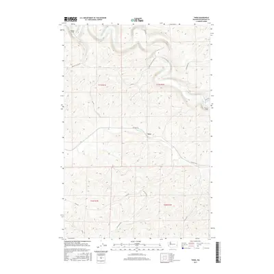
2017 Map of Thera
USGS Topo · Published 2017About this map
The Palouse River winds through the northern portion of this landscape, its steep, terraced banks defining the topography of the region near Thera. This settlement is located at the confluence where Rebel Flat Cr meets the main drainage, a site of historical importance for local transit. The map documents several key crossings, including Torrence Bridge and Matlock Bridge, which connect the upland agricultural plateau to the river valley. Numerous roads named for local families and landmarks, such as Cutler-Lautenschlager Rd, Frank Feenan Rd, and Ed Hamilton Rd, reveal a network of land ownership and rural development that has persisted into the 21st century. The map illustrates how the deep coulees and ridges of the Palouse continue to shape the movement of people and the placement of infrastructure in this Whitman County area.
Find a feature on this map
20 named features on this map. Tap any name to fly to it.
Don’t see what you’re looking for? This feature index may not catch every label — zoom into the map to look around manually.
Map Details
Editions of this 2017 Thera Map
This is the sole edition of this map. No revisions or reprints were ever made.
Other maps of this area

1903 · Oakesdale
USGS Topo · 1:125,000

1905 · Oakesdale
USGS Topo · 1:125,000

1910 · Pullman
USGS Topo · 1:125,000

1950 · Endicott
USGS Topo · 1:62,500

1955 · Pullman
USGS Topo · 1:250,000

1955 · Spokane
USGS Topo · 1:250,000

1958 · Spokane
USGS Topo · 1:250,000

1958 · Pullman
USGS Topo · 1:250,000

1964 · Diamond
USGS Topo · 1:24,000

1964 · St. John
USGS Topo · 1:24,000