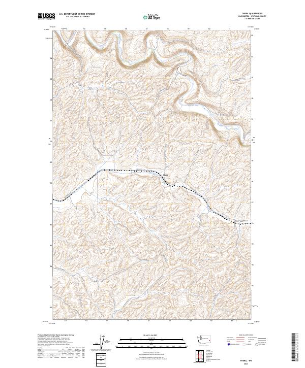
2023 Map of Thera
USGS Topo · Published 2023About this map
Thera sits at the heart of this landscape in Whitman County, situated near the confluence of local drainages that define the region's topography. The Palouse River winds through the northern portion of the quadrangle, carving a distinct valley through the undulating terrain of the Palouse hills. Further south, Rebel Flat Creek flows through the center of the sheet, followed closely by the Endicott E Rd. The land is organized by a traditional grid of rural routes, often named for local families and settlers, including Kaiser Rd, Ed Hamilton Rd, and Frank Feenan Rd. These road names and the placement of Thera reflect the persistent agricultural character of eastern Washington, where the network of ways like the Endicott-St John Rd serves as the primary connection between isolated homesteads and larger grain-handling centers.
Find a feature on this map
19 named features on this map. Tap any name to fly to it.
Don’t see what you’re looking for? This feature index may not catch every label — zoom into the map to look around manually.
Map Details
Editions of this 2023 Thera Map
This is the sole edition of this map. No revisions or reprints were ever made.
Other maps of this area

1903 · Oakesdale
USGS Topo · 1:125,000

1905 · Oakesdale
USGS Topo · 1:125,000

1910 · Pullman
USGS Topo · 1:125,000

1950 · Endicott
USGS Topo · 1:62,500

1955 · Pullman
USGS Topo · 1:250,000

1955 · Spokane
USGS Topo · 1:250,000

1958 · Spokane
USGS Topo · 1:250,000

1958 · Pullman
USGS Topo · 1:250,000

1964 · Diamond
USGS Topo · 1:24,000

1964 · St. John
USGS Topo · 1:24,000