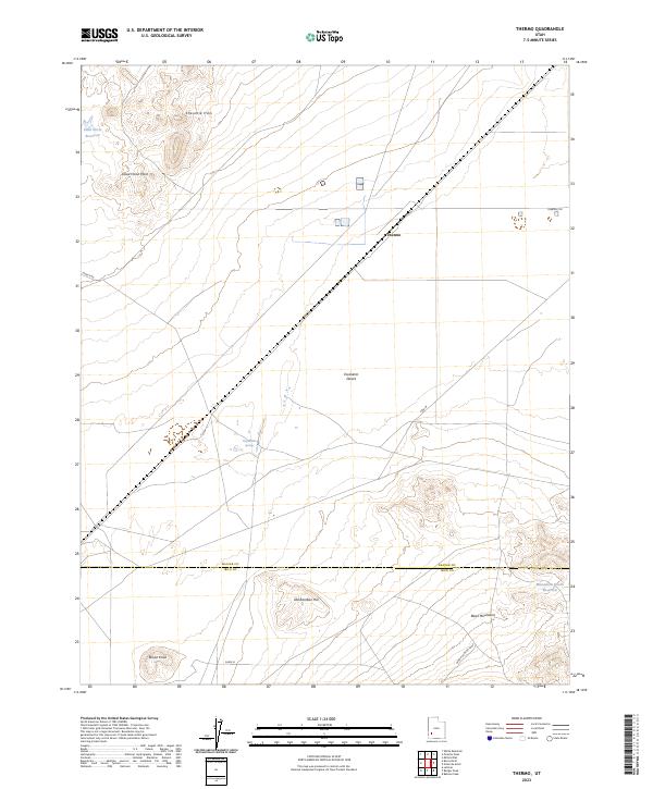
2023 Map of Thermo
USGS Topo · Published 2023About this map
The Escalante Desert dominates the central landscape of this western Utah region, where the historical rail stop of Thermo marks a crossing in the arid terrain. To the north, the Shauntie Hills and Dead Horse Point provide significant relief, while the south is defined by the Black Mountains and Old Rambler Hill. This 2023 survey documents the intersection of hydrology and desert life, featuring the Thermo Hot Springs and the Dead Horse Reservoir near the northern boundary. The map captures the dividing line between Beaver and Iron Counties, showing a network of rural routes such as Jockey Rd and Wood Canyon Loop that service the scattered water sources and landforms, including the isolated Brown Knoll and the Monument Knolls Reservoir to the southeast.
Find a feature on this map
15 named features on this map. Tap any name to fly to it.
Don’t see what you’re looking for? This feature index may not catch every label — zoom into the map to look around manually.
Map Details
Editions of this 2023 Thermo Map
This is the sole edition of this map. No revisions or reprints were ever made.
Other maps of this area

1953 · Ninemile Knoll
USGS Topo · 1:24,000

1953 · Milford Flat
USGS Topo · 1:24,000

1953 · Richfield
USGS Topo · 1:250,000

1958 · Richfield
USGS Topo · 1:250,000

1958 · Thermo
USGS Topo · 1:62,500

1958 · Milford
USGS Topo · 1:62,500

1959 · Frisco
USGS Topo · 1:62,500
1971 · Burns Knoll
USGS Topo · 1:24,000
1971 · Latimer
USGS Topo · 1:24,000

1980 · Wah Wah Mts. South
USGS Topo · 1:100,000