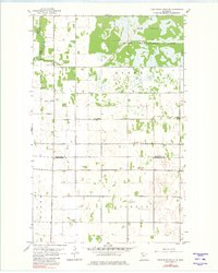
1961 Map of Thief River Falls NE
USGS Topo · Published 1980About this map
Elm Lake and the surrounding marshes of the Wildlife Management Area dominate the northern reaches of this landscape, where the Thief River winds along the western boundary. The terrain reflects the transition from wild wetlands to structured agricultural townships like Agder, Excel, and Silverton. A network of drainage infrastructure, such as County Ditch No 20, illustrates the mid-century effort to reclaim low-lying lands for farming. This 1961 survey provides a snapshot of rural community life before many small institutions consolidated, showing the locations of country schools like Sunnyside Sch and several local congregations. Genealogists will find particular value in the clearly marked Satersdal Cem and the Silverton Ch Cem, preserving the locations of early parish burial grounds within the Marshall and Pennington county lines.
Find a feature on this map
18 named features on this map. Tap any name to fly to it.
Don’t see what you’re looking for? This feature index may not catch every label — zoom into the map to look around manually.
Map Details
Editions of this 1961 Thief River Falls NE Map
2 editions found
Other maps of this area

1918 · Rollis
USGS Topo · 1:62,500

1918 · Middle River
USGS Topo · 1:62,500

1943 · Rollis
USGS Topo · 1:62,500

1943 · Thief River Falls
USGS Topo · 1:62,500

1952 · Thief River Falls
USGS Topo · 1:250,000

1954 · Roseau
USGS Topo · 1:250,000

1956 · Thief River Falls
USGS Topo · 1:250,000

1957 · Roseau
USGS Topo · 1:250,000

1957 · Thief River Falls
USGS Topo · 1:250,000

1958 · Roseau
USGS Topo · 1:250,000