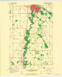
1959 Map of Thief River Falls
USGS Topo · Published 1960About this map
Thief River Falls serves as the regional hub at the confluence of the Red Lake River and its northern tributaries. This late 1950s survey captures the city during a period of mid-century development, marked by the presence of the Thief River Falls Airport to the south and a growing municipal infrastructure including a Sewage Disposal plant and Waterworks. The urban center is densely detailed with public institutions like Lincoln High Sch and St Bernard Sch, while the outlying areas of North and Rocksbury townships maintain their agricultural character.
Find a feature on this map
47 named features on this map. Tap any name to fly to it.
Don’t see what you’re looking for? This feature index may not catch every label — zoom into the map to look around manually.
Map Details
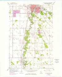
Editions of this 1959 Thief River Falls Map
2 editions found
Other maps of this area

1918 · Terrebonne
USGS Topo · 1:62,500

1918 · Red Lake Falls
USGS Topo · 1:62,500

1918 · Viking
USGS Topo · 1:62,500

1943 · Thief River Falls
USGS Topo · 1:62,500

1952 · Red Lake Falls
USGS Topo · 1:62,500

1952 · Grand Forks
USGS Topo · 1:250,000

1952 · Thief River Falls
USGS Topo · 1:250,000

1956 · Thief River Falls
USGS Topo · 1:250,000

1956 · Grand Forks
USGS Topo · 1:250,000

1957 · Thief River Falls
USGS Topo · 1:250,000
Featured Places
- Thief River Falls, MN
- Saint Hilaire, St. Hilaire
- Northside Trailer Park, St. Hilaire
- Aaesby Trailer Court, MN
- St. Hilaire, MN