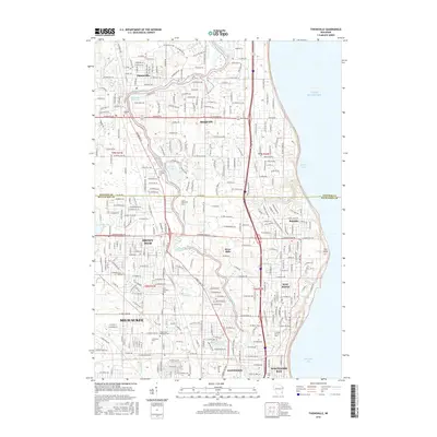
2016 Map of Thiensville
USGS Topo · Published 2016About this map
The Milwaukee River meanders through a series of north-suburban communities as they stood in the mid-2010s, defining the boundaries and character of Thiensville, Mequon, and River Hills. The landscape is a dense network of residential development and preserved green space, with notable features like the Thiensville Millpond and Lac Du Cours indicating the area's aquatic orientation. For family historians, the map is a significant record of regional cemeteries, including Mequon Cem, Saint Peters Cem, and the large Graceland Cem in the southern portion of the sheet.
Find a feature on this map
105 named features on this map. Tap any name to fly to it.
Don’t see what you’re looking for? This feature index may not catch every label — zoom into the map to look around manually.
Map Details
Editions of this 2016 Thiensville Map
This is the sole edition of this map. No revisions or reprints were ever made.
Other maps of this area

1892 · Milwaukee
USGS Topo · 1:62,500

1892 · Waukesha
USGS Topo · 1:62,500

1892 · Port Washington
USGS Topo · 1:62,500

1901 · Milwaukee
USGS Topo · 1:62,500

1901 · Waukesha
USGS Topo · 1:62,500

1904 · West Bend
USGS Topo · 1:62,500

1904 · Port Washington
USGS Topo · 1:62,500

1906 · Waukesha
USGS Topo · 1:62,500

1906 · Milwaukee
USGS Topo · 1:62,500

1954 · Milwaukee
USGS Topo · 1:250,000